Command line script to generate pcodes from your spatial dataset

Project description
pcodegenerator
Generates pcodes for geospatial datasets based on COD
Install :
pip install pcodegenerator
Make sure you have ogr2ogr installed on your machine too.
Prepare :
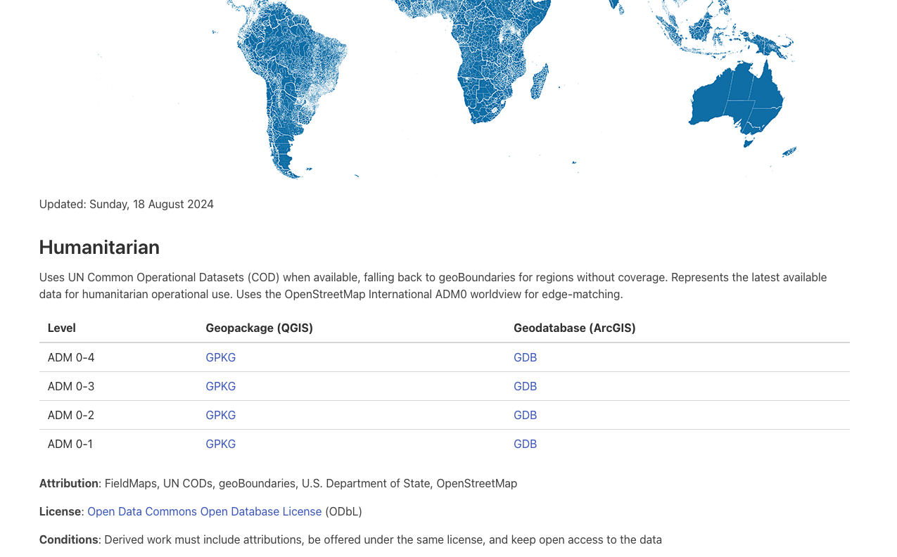
Download / Update with the latest COD edge matched dataset , Know more https://fieldmaps.io/
pcodeprepare --admin 4
Usage
Example to add pcode dataset on localities
pcodegenerator --source ./adm4_polygons.parquet --input locality.geojson --output locality_pcodes.geojson
Resources :
All credits to respective providers
ISO2 naming
Source : https://www.fao.org/nocs/en/
Multilingual database of Names of Countries and Territories (NOCS)
P-Codes Generation Logic
https://humanitarian.atlassian.net/wiki/spaces/imtoolbox/pages/222265609/P-codes+and+gazetteers

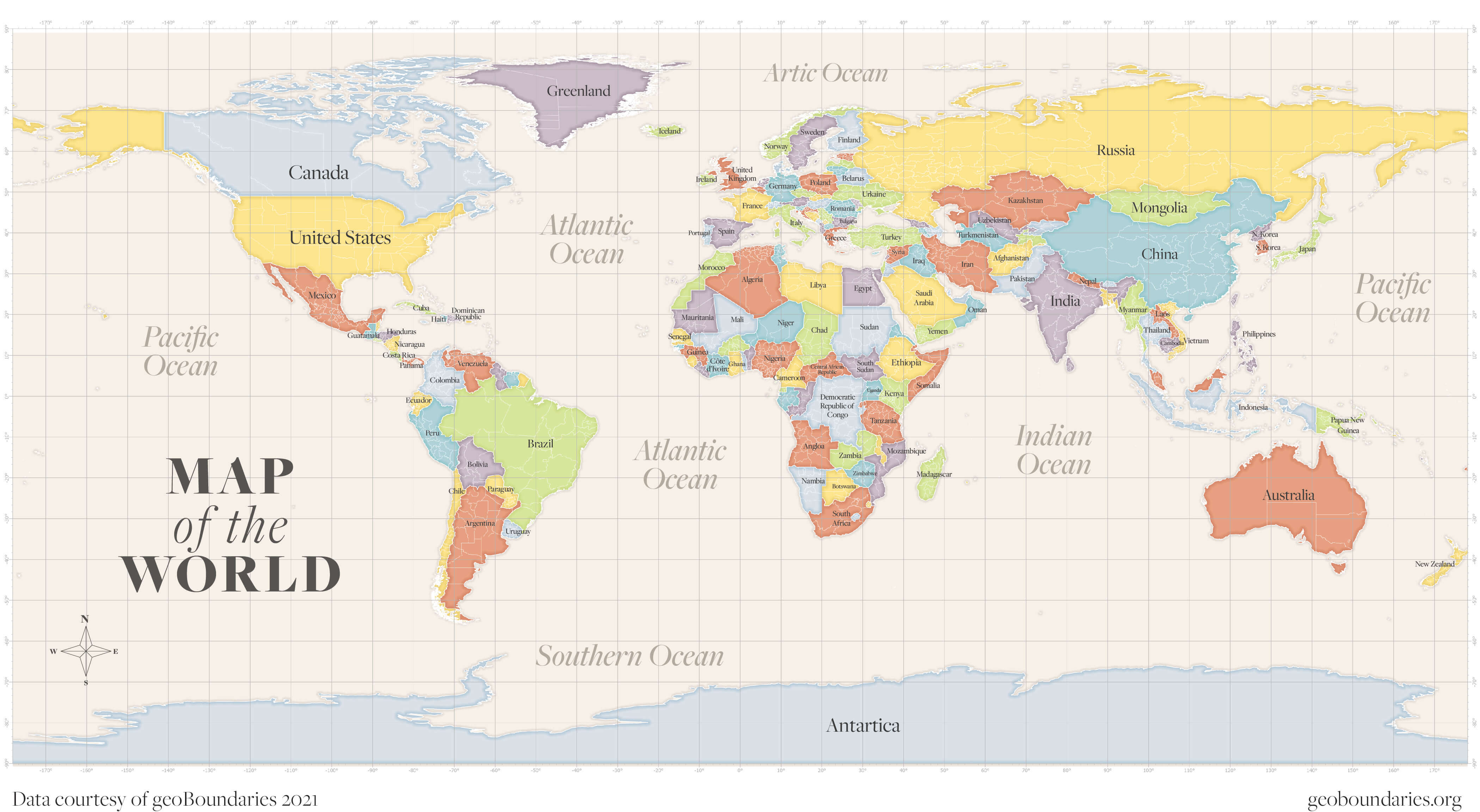
Admin boundaries
Source : https://www.geoboundaries.org/ License : CC BY 4.0 license
Global boundaries with COD attributes ( Including subnational geom )
Source : https://fieldmaps.io/data
API : https://data.fieldmaps.io/edge-matched.json
License : Open Data Commons Open Database License (ODbL)